Misty Mountain Hop
I had always planned to assault Bukhan-san, and as the weather started to get colder, I decided to masochistically hold off a little longer until the snow came. No use in doing things by halves. Keeping tabs on numerous weather websites, I decided that last Saturday would be an ideal day for this adventure, freezing, sunny and a little snowy. However, it didn't all go EXACTLY to plan!
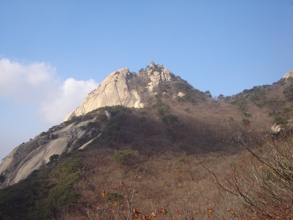
Bukhan-san is one of the smallest National Parks in Korea, about 80 square kilometres, but due to it's proximity to Seoul, it attracts the most annual visitors. We pass this striking region every time we go to Seoul, and while it may not be one of the highest mountain areas in the country, it rises very sharply and dramatically from the base. Possibly because we had grown so used to viewing it from the train or the bus, I had fooled myself into thinking the park consisted merely of the 3 visible peaks, and had imagined hiking it may prove a little dull, with boring views over the city of Seoul, and very little else of interest.
This was very foolish, and I completely underestimated what the interior of the park contained.
My plan was to leave around 9am, but due to my inexplicable excitement, I couldn't sleep and got on the bus for 7am! Unfortunately, I awoke to the worst fog I have ever seen, with visibility of probably only 3 metres in front of your face. I laughed at possibly the worst hiking conditions ever, but had no intention of pulling out now. I usually skip such details as directions, but will include some this time, as I had a bit of trouble finding the information online myself and other people might find it useful.
Coming from Ilsan, the best route was to take the 9703 bus to Gupabal subway station. From there, I had heard that the 156-1 bus ran to the West Gate, but the one I found was the 504, I think. From here to the West Gate only took about 50 minutes. Conveniently, there should always be some Korean hikers to follow; even on an early, foggy morning like mine there were a couple of obvious hikers to keep me right.
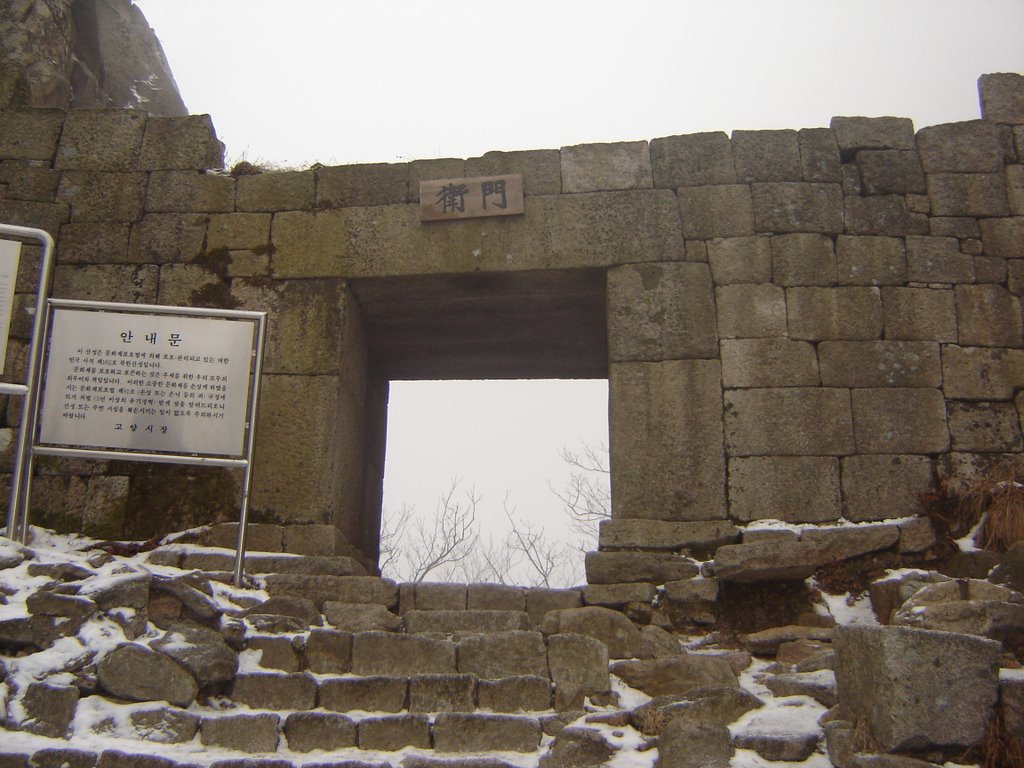
At the West Gate, I could barely see ANY mountains through the fog, and had no idea where I was going. You may have noticed by this point that I was alone in this little expedition! Due to the freezing conditions, and the worrying stories regarding the difficulty of some parts of the climb, I had no companions! As I passed a small cart selling climbing equipment, I remembered reading how many steep areas were accessible only by using the steel cables provided, and stopped to buy a pair of gripped gloves. These only cost 50p, and proved to be absolutely indispensible. I have no doubt in my mind that I would not have made it to the summit without these badboys.
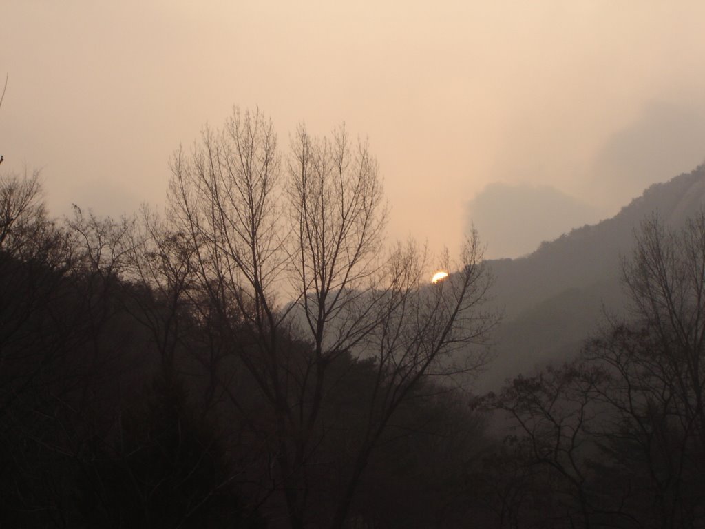
I entered the park as the sun was beginning to rise, and it seemed that the insane fog may subside, but this was to be only a temporary relief.
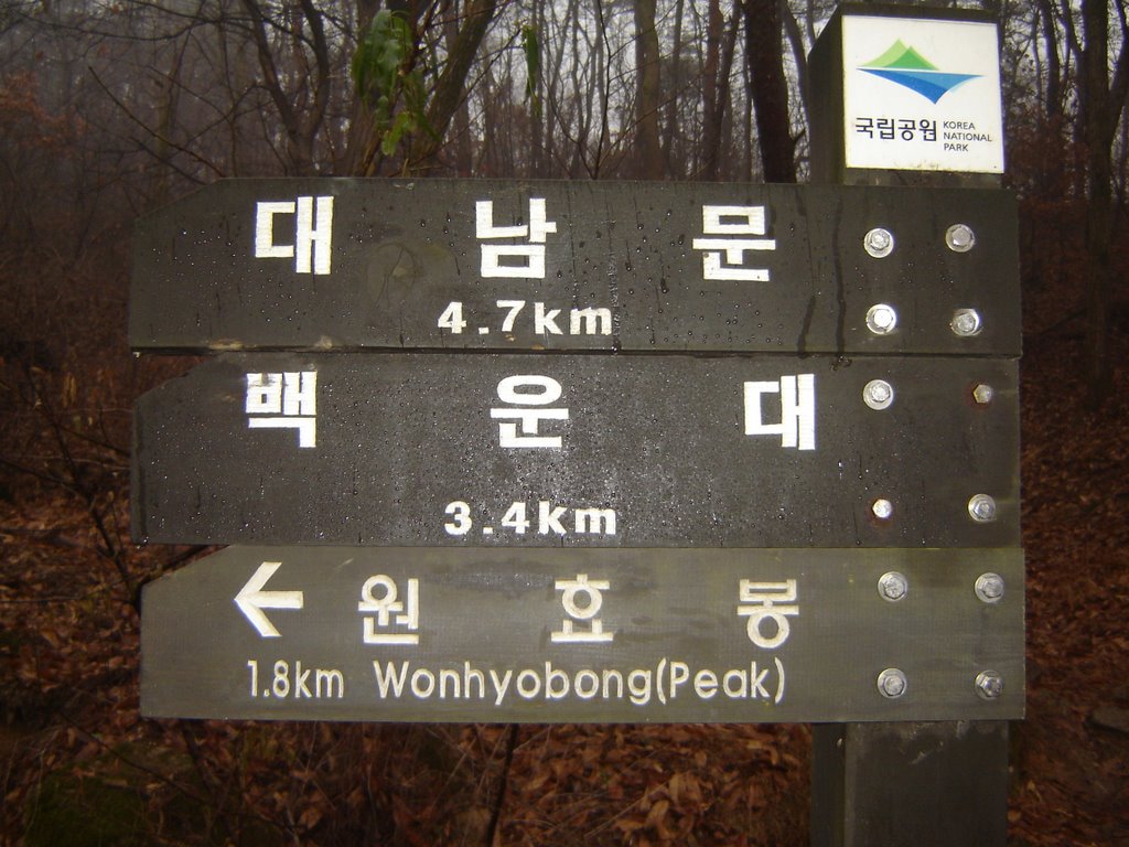
My plan was to take a trail to the highest peak, Baegundae (middle sign, above), then take the long ridge trail to the South Gate, and finally to descend through the interior valley and eventually arrive back at my point of departure. I didn't really have any idea of how far, or how long this would take, but I was determined to complete my plan.
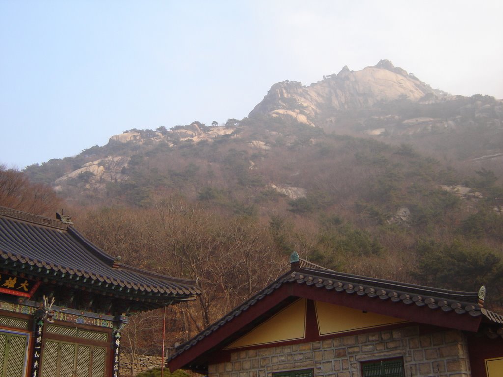
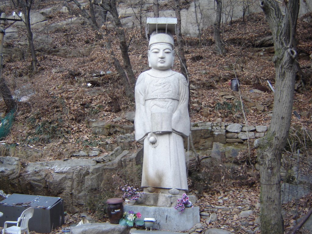
My first stop was a temple I had read about, named Sangeun-sa. This temple is tucked away inconspicuously up a small trail just before Daedong-sa. My reasons for seeking out this place, were to partake in the healing waters said to exit the mountain at this spot. According to legend, the white carved buddha in the cave here was carved by a leper who was eventually cured of his disease by drinking the water which drips down the walls of this cave. The temple and cave, have now become a pilgrimage site for others seeking a miraculous cure. As you probably know, I have had a seriously wrecked knee for a few years now, so even before we left for Korea I had decided to come here at some point.
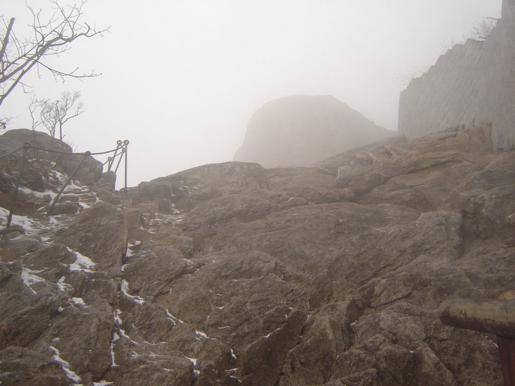
The view across the lower peaks as the sun came up through the mist was incredible. From Sangeun-sa, there was no time for pictures as I battled up a steep and arduous trail. I spoke to many Koreans who voiced their extreme concern over my attire, in particular my tattered Adidas. Koreans can be very sheeplike, and it's quite rare to see anyone displaying any individuality in their clothing. Nowhere is this more true than on a mountain. Everyone looks identical. It's like every person has just been dipped in a large vat of North Face and then handed a pair of aluminium walking sticks. The thought that a foreigner wearing a fake North Face coat (Black Wind!), flared jeans, and old trainers could climb a mountain is seemingly utterly ridiculous to them! One guy, as nice as he was, told me I might manage the trail as far as Wi-Mun, but there was absolutely no chance I could get up to the peak. I tried to placate him with a smile and a promise that if it seemed too difficult I wouldn't attempt it, and he remained unsmiling and staunch in his opinion that it was impossible. Perhaps it was only genuine concern, but the urge to surprise these meddlers with the fact I'd been managing to put one foot in front of the other for about 26 years without falling over, was quite tempting. Having said that, the ascent to the peak, DID turn out to be much harder than I anticipated, and obviously I would have bought proper footwear by now if my feet weren't so damn massive. You know what they say about guys with big feet? You'll go barefoot in Korea.
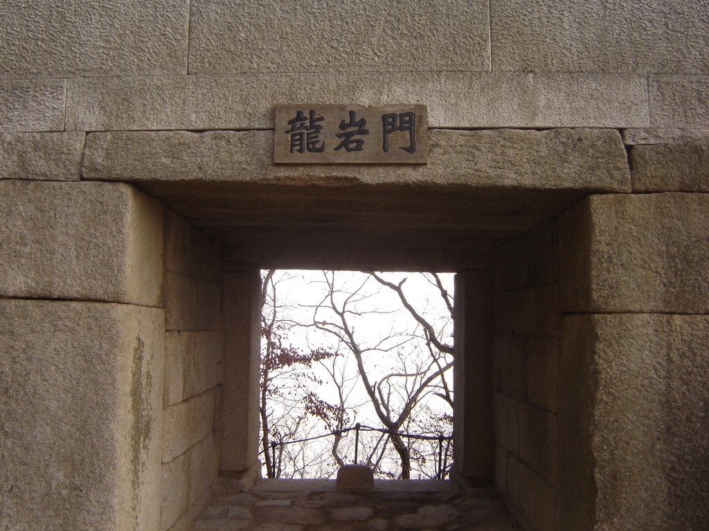
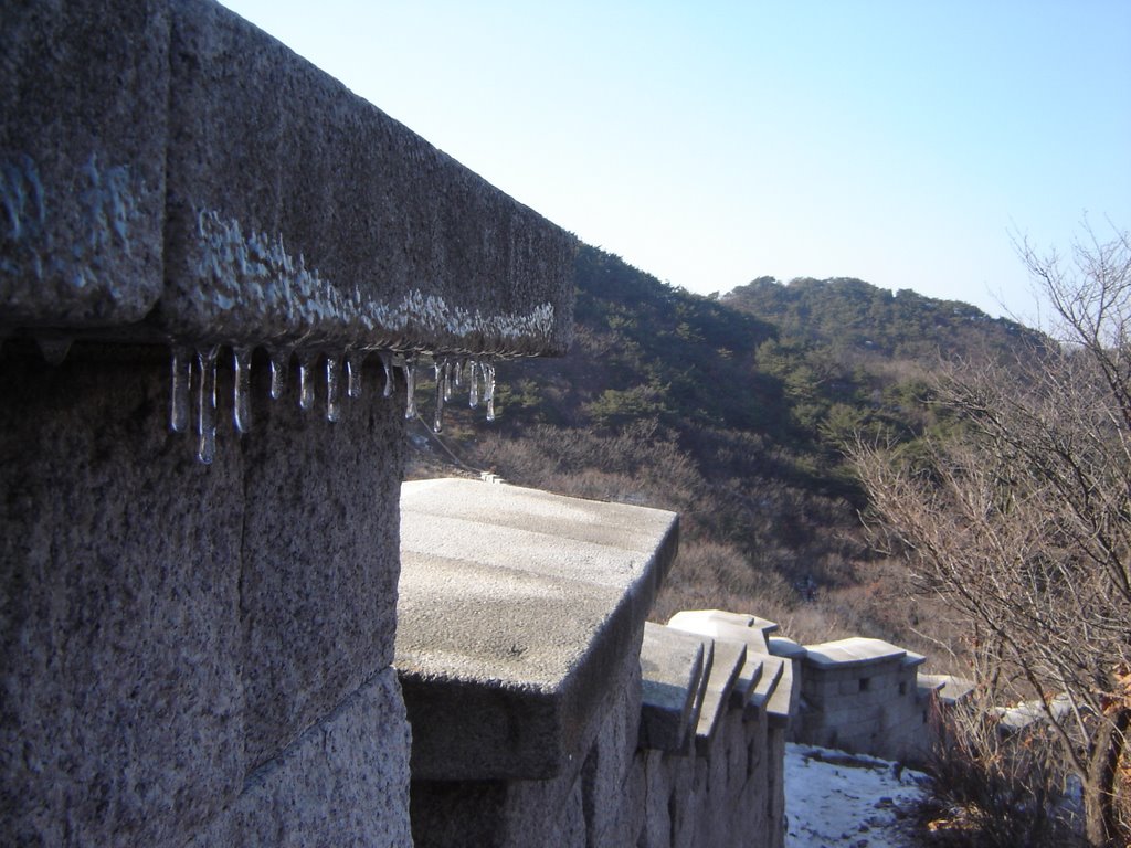
By the time I reached Wi-Mun, the trail had become extremely icy and treacherous, and the fog had enveloped the area turning it into a smoky void. This was decision time, climb up to Baegundae, or miss it out and begin the ridge trail. I was adamant that this was to be a trip of no half measures, and it didn't take much contemplation before I started the climb.
Here we go! Thank God for my fashionable gripped gloves! It was at this point that the Korean climbers decided their expensive hiking boots weren't quite enough, and stopped to apply steel climbing spikes, while continuing to cast disparaging glances at my formidable Adidas Superstars.
From here, I should have been able to see for miles and miles. In fact, an adjacent peak, Insu-bong was apparently right in front of me!
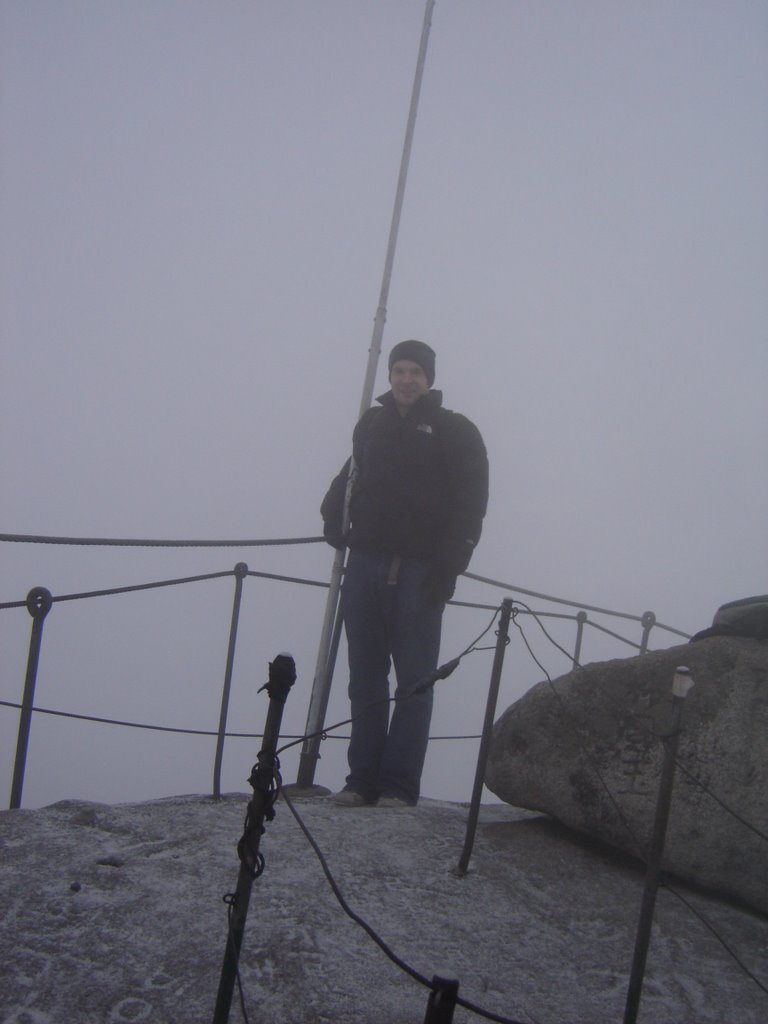
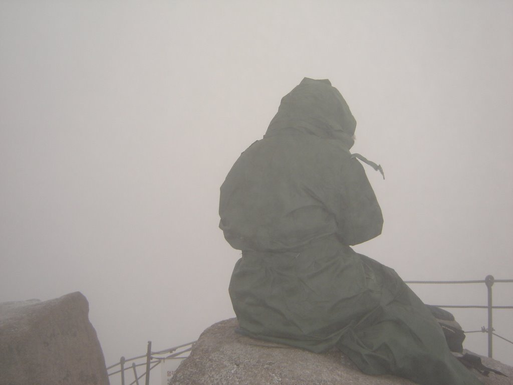
The peak itself is very tiny, probably enough room for 10 people. It was complete ice, and the low safety rope brought back memories of drunkenly navigating my way along the perilous balcony of my old Hilltown flat. The guy who took this picture for me slipped and nearly fell off the edge. Should've worn some Adidas!
As I approached the summit, I heard a strange voice carried on the wind, and in between trying not to die, I couldn't figure out what was going on up there. What I found at the top, was representative of many of the discoveries that have made this year unforgettable. Whatever we end up doing, there always seems to be something bizarre which twists the situation into an altogether more alien and remarkable experience. The source of this noise turned out to be a very old woman, at least in her seventies, perched on a rock and chanting prayers into the surrounding storm. I honestly have no idea how she got up there. No idea. Here's a quick clip of her. I tried to be discreet, but I think she caught me near the end. I bet I'm cursed!
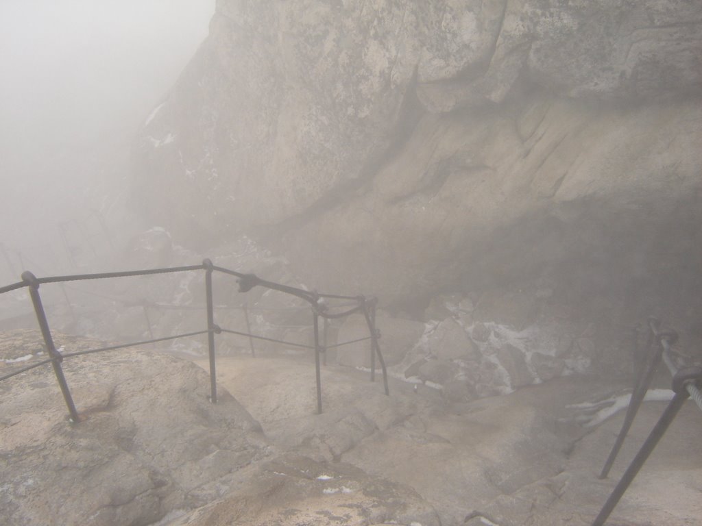
Getting down again was bloody difficult.

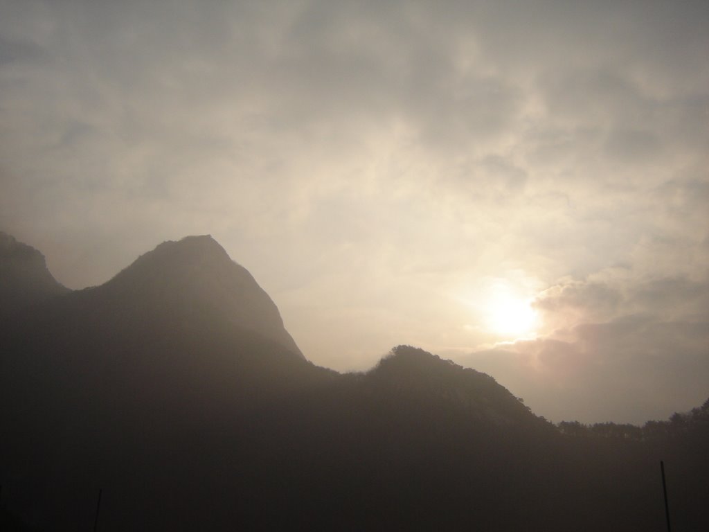
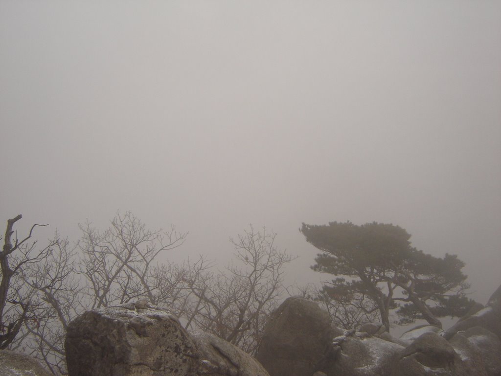
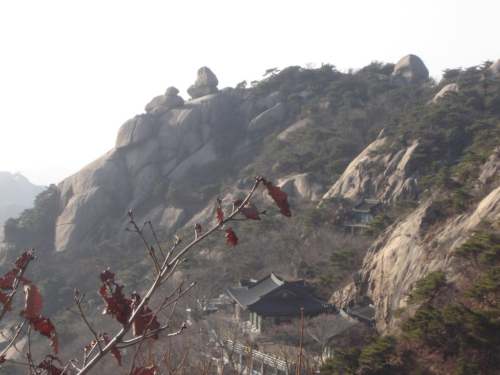
Of course, once I had descended from the peak, I looked up to see the fog finally subsiding. I was up there! From the point of this picture, I began the ridge trail. All in all, the climb from the park gate to the peak of Baegundae took about 4 hours. I'm sitting here drinking some red wine now, so this blog is about to enter the "Photo/Caption" stage...... Here's a bunch of photos showing the occassionally tricky ridge trail all the way around to Daenammun (Great South Gate).
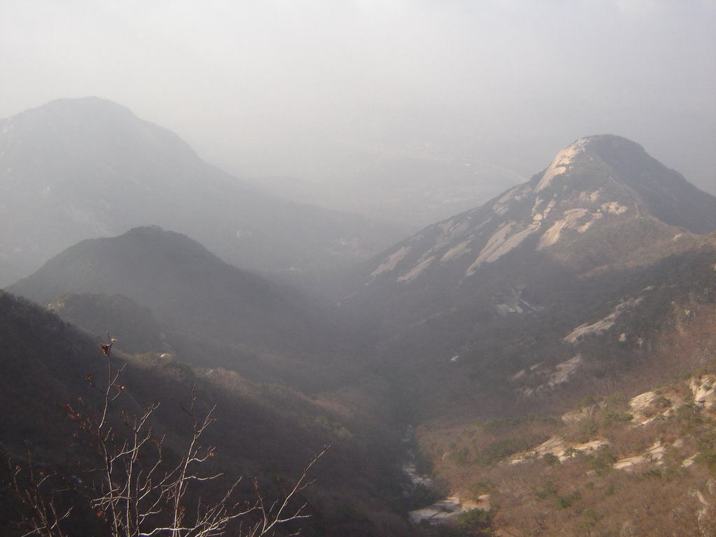
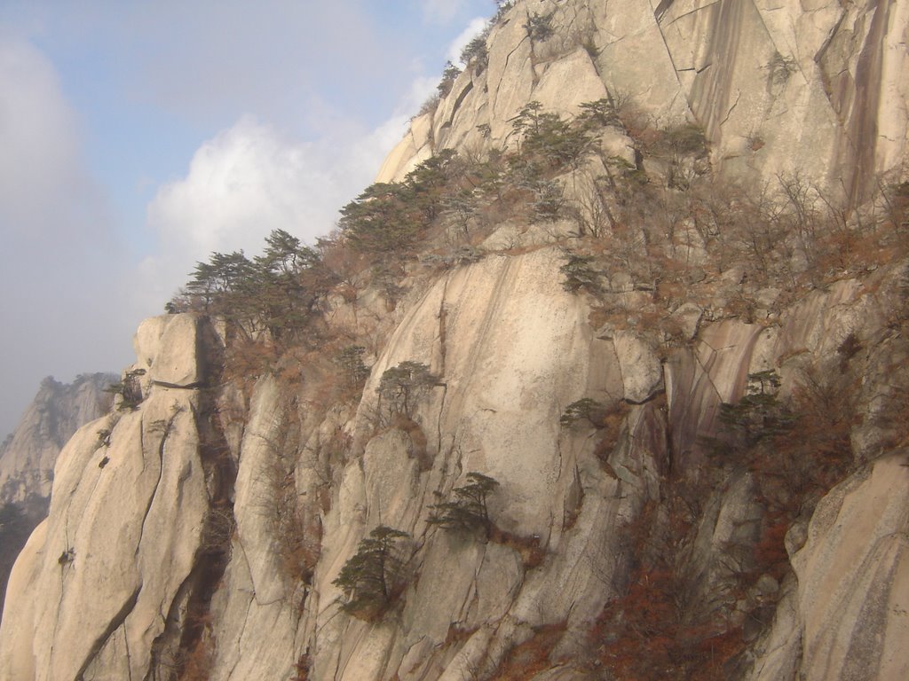
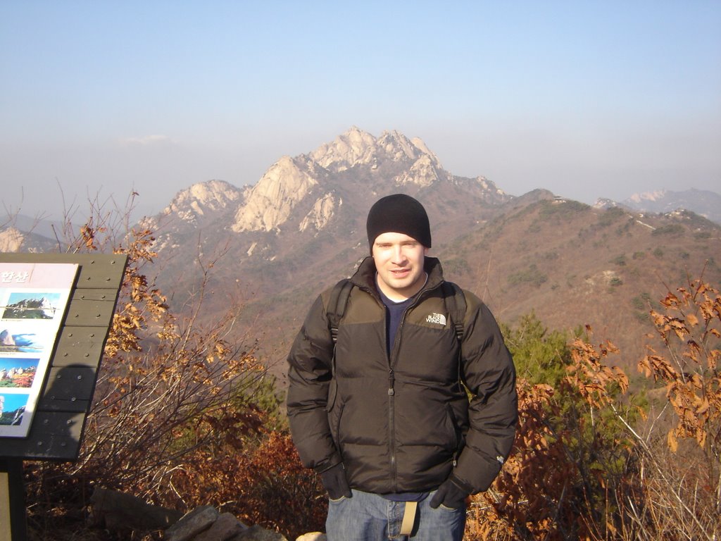
This picture was taken not too far from the south gate. In the distant background you can see Baegundae, the peak I had earlier climbed through all that fog. The weather had cleared up considerably by this point.
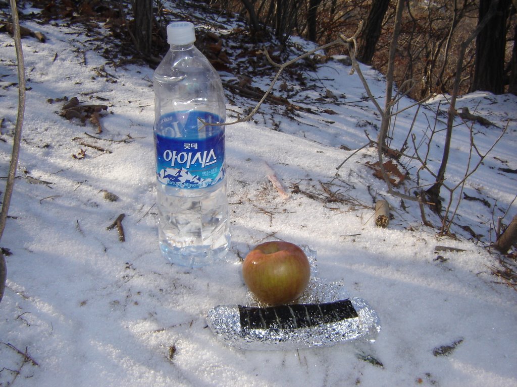
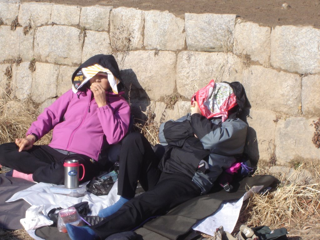
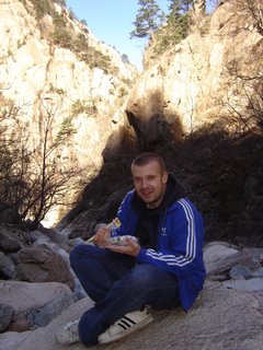
Best lunch ever. Kimbab, water, and a beast of an apple. After all the exertion, this was....Best. Lunch. Ever.
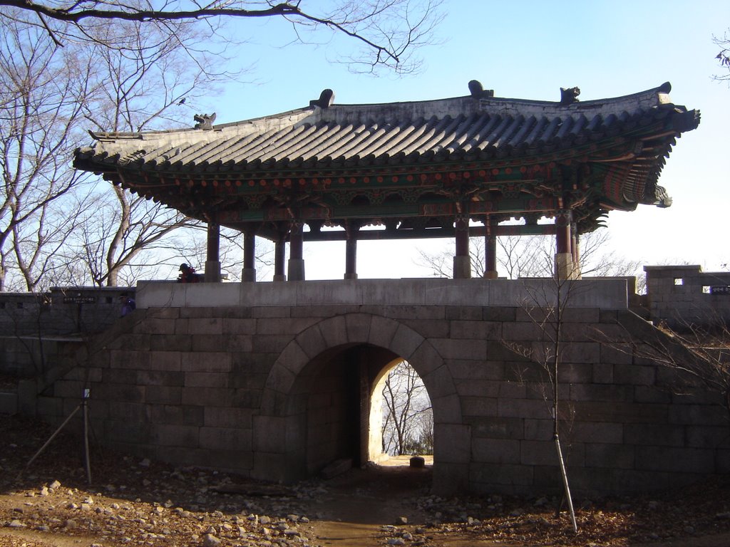
Oh it's bloody cold. The ridge trail mostly follows the old wall of Bukhan Sanseong (Fortress). This fortress must have been a monster, with walls 9 metres high. Can you imagine trying to conquer this place? Hiking up for hours then having 9 metre walls impeding your progress. It must have been quite a stronghold.
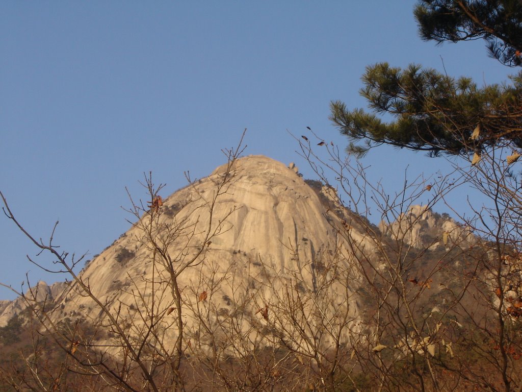
Nojeok-bong, the peak above, is the subject of a fairly entertaining and preposterous legend. Allegedly, the famous Joseon dynasty warrior monk Sammyeong-daesa came to Bukhan-san when Japanese forces pushed up the peninsula in the 1590's. He gathered his men in this valley, and in order to outwit the invading japanese troops, he ordered his men to cover Nojeok-bong in straw bags to make it resemble a massive pile of rice. Seeing it, the Japanese decided there must certainly be too many Korean soldiers based in the valley for them to succeed in battle, and even if they were to lay siege, it would be impossible to starve them out. The trick worked, and the Japanese withdrew. Allegedly. Genius story nonetheless.
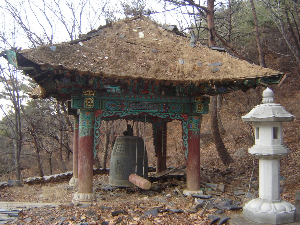
After reaching the South Gate, I made my way back to the West Gate by way of the inner valley trail, by far the easiest stretch of the day, thankfully. The entire trek took about 9 hours, and was absolutely incredible. I finished off with a couple of beers under the watchful gaze of these buddha statues at an old abandoned temple. This dog was so cool, I wanted to take him home. The guilt of the Boshintang experience brought a bitter taste to my mouth. I try to tell myself I ate an ugly ill-tempered bastard of a dog anyway, not a groovy dog like this. So it's all good.
Got home at 6pm, got drunk, went into Hongdae, got more drunk, danced to a band doing a funky instrumental cover of Paranoid Android, had a huge snowball fight, a potentially bad altercation with a dodgy taxi driver, and hurt like hell for the next whole week due to the hike. My muscles were as sore as an epilectic person's after a rave. But it was well worth it, bring on the next one.
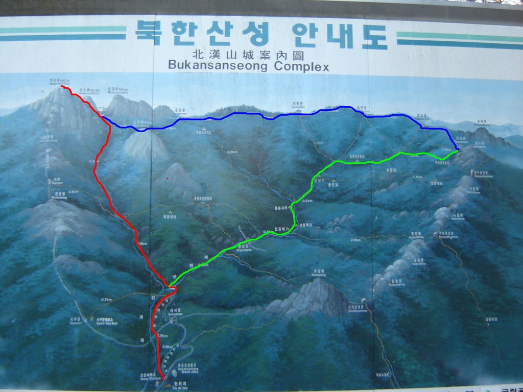 (Starting at the bottom.... RED- West Gate-Baegundae, BLUE- Wimun-South Gate (Ridge trail), GREEN- South Gate-West Gate (Valley trail).)
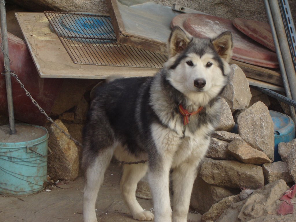
posted by Waddell @ 7:19 AM
0 comments
![]()

0 Comments:
Post a Comment
<< Home